Geographical Significance of the Gibraltar Strait
The Gibraltar Strait is a narrow waterway that connects the Atlantic Ocean to the Mediterranean Sea, serving as a crucial geographical landmark between southern Spain and northern Morocco. Spanning approximately 13 kilometers at its narrowest point, the strait sits at the crossroads of Europe and Africa, making it one of the most strategically significant maritime passages in the world. Its unique geography not only facilitates vital international shipping routes but also plays a major role in controlling naval access between two major bodies of water.
Historically, the Gibraltar Strait’s strategic location has rendered it a key military and trade chokepoint. Control over the strait has meant influence over the maritime traffic entering or leaving the Mediterranean, making it a coveted asset for empires and nations throughout history. The narrow passage has been a focal point for naval powers looking to secure their dominance, whether it was the Phoenicians, Romans, Moors, or the British Empire. This significance continues today, as modern naval and commercial vessels rely heavily on this route for efficient movement between the Atlantic and Mediterranean regions.
The geography of the Gibraltar Strait also affects its climatic and oceanographic conditions, which in turn shape regional ecosystems and maritime navigation. The contrasting waters of the Atlantic and Mediterranean meet here, resulting in strong currents and complex tidal patterns. These natural phenomena have historically challenged explorers and sailors but have also provided natural defense mechanisms for those who controlled the strait. Moreover, the presence of the towering Rock of Gibraltar serves as a prominent landmark and a symbol of the strategic importance embedded in the geography of the strait.
In summary, the geographical position of the Gibraltar Strait has ensured its lasting strategic importance. It has been a critical point for controlling naval and trade routes, shaped military engagements, and influenced geopolitical dynamics for centuries. Its strategic location continues to hold immense value in contemporary global trade and naval power projection, underscoring the enduring legacy of geography in shaping human history.
Location and Physical Characteristics
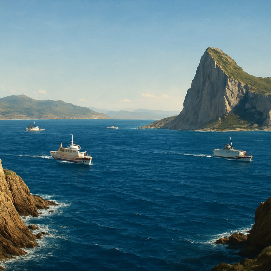
The Strait of Gibraltar is a narrow passage that serves as a natural boundary between the southern tip of Spain in Europe and the northern coast of Morocco in Africa. This strategic waterway connects the Atlantic Ocean to the Mediterranean Sea, making it one of the most significant maritime routes in the world. Geographically, the strait spans approximately 14 kilometers (9 miles) at its narrowest point, where the distance between the Rock of Gibraltar and the Moroccan coast is the shortest.
In terms of physical features, the strait is characterized by its relatively shallow and turbulent waters, which are influenced by strong tidal currents from both the Atlantic and Mediterranean sides. The seabed is rugged with underwater ridges and channels, which contribute to the complex water flow patterns. The surrounding terrain includes rocky cliffs, notably the towering Rock of Gibraltar on the northern side and prominent hills on the African coast, which create a dramatic and distinctive natural landscape.
The narrow passage of the Gibraltar Strait, combined with its unique physical geography, has played a crucial role in its history, navigation, and ecology. Its dimensions and natural features have influenced everything from ancient exploration to modern shipping, making it a vital corridor that bridges two continents while remaining a challenging and fascinating physical environment.
Strategic Importance in Trade and Military History
The Strait of Gibraltar has long been recognized as a critical naval passage, serving as a gateway between the Atlantic Ocean and the Mediterranean Sea. Its strategic location has ensured its prominence as an essential trade route, facilitating the movement of goods and resources between Europe, Africa, and beyond. Control over this narrow waterway has often meant dominance over naval and commercial activity in the region.
Throughout history, the strait’s significance in military history cannot be overstated. Various empires and nations have vied for control of the strait to secure naval supremacy and protect their maritime interests. Its control allowed for effective monitoring and regulation of naval traffic, which was crucial during times of conflict. Commanding the strait provided military advantage by allowing forces to blockade adversaries or safeguard their own trade fleets, reinforcing its strategic value.
Naval control of the Strait of Gibraltar has been a pivotal factor in shaping military strategies, especially during key historical conflicts such as the Napoleonic Wars and the World Wars. The ability to dominate this passage influenced the power balance in the Mediterranean region and beyond. Even today, the strait maintains its importance for global trade and military logistics, underscoring its enduring role as a vital artery in international maritime affairs.
Historical Exploration and Early Discoveries
The Strait of Gibraltar has long served as a crucial gateway between the Atlantic Ocean and the Mediterranean Sea, attracting explorers and ancient civilizations for millennia. Early exploration of this natural passage was driven by its strategic importance for navigation and trade, deeply influencing the development of early maritime routes and the exchange of cultures. Ancient seafarers recognized the strait as a vital link in their voyages, which led to significant discoveries and advances in ancient navigation techniques.
Early exploration efforts around the Gibraltar Strait can be traced back to the Phoenicians, who were among the first to document the region. Known as master navigators and traders, the Phoenicians established ports along the coasts, facilitating maritime connectivity. Their explorations revealed the strait as a natural boundary and an essential passage for ships traveling between the Mediterranean basin and the wider Atlantic world. This early recognition underscored the strait’s role not only as a geographic landmark but also as a hub of commercial and cultural exchange.
Following the Phoenicians, the ancient Greeks and later the Romans further expanded their understanding of the strait through exploratory expeditions and the documentation of their findings. The Greeks referred to the area as the “Pillars of Heracles,” emphasizing its mythological and navigational significance. These early discoveries contributed to the growing body of knowledge regarding ancient navigation, where sailors relied on natural landmarks, stars, and rudimentary maps to traverse these challenging waters successfully.
Aside from navigation, the region around the strait became a site of cultural importance. The early civilizations left behind archaeological evidence of settlements and trade activities that reveal a rich history of human interaction and discovery. These findings demonstrate how exploration in the strait was not limited to maritime ventures but also involved terrestrial exploration and territorial claims shaped by the geographical prominence of the region.
In summary, the historical exploration of the Gibraltar Strait illustrates the fascinating interplay of exploration, early discoveries, and ancient navigation. The strategic position of the strait attracted the attention of pioneering civilizations who not only mapped and traversed these waters but also significantly contributed to the collective understanding of the Mediterranean world and beyond. Their legacy continues to highlight the importance of the strait in connecting different cultures and shaping the course of ancient history.
Ancient Civilizations and Maritime Navigation
The Strait of Gibraltar has long been a crucial passageway for ancient civilizations such as the Phoenicians and Romans, who recognized its strategic importance for trade and travel. These civilizations developed advanced navigation techniques that allowed them to traverse the difficult waters of the strait with increasing confidence and precision. The Phoenicians, renowned for their seafaring skills, used coastal navigation complemented by knowledge of the stars, winds, and currents to safely guide their ships across the strait. They established trade networks connecting the Mediterranean with the Atlantic, transporting goods like metals, textiles, and spices.
The Romans later expanded on these maritime pathways, capitalizing on the strait’s geographic position as a gateway between continents. They improved navigation charts and developed more sophisticated sailing vessels, enabling more frequent and reliable crossings. Roman maritime trade benefited greatly from these innovations, as the strait became a busy corridor for the transport of grain, olive oil, and other commodities critical to the empire’s economy. Their ability to control and navigate the strait effectively also contributed significantly to their military and political dominance in the region.
In summary, the navigation techniques perfected by the Phoenicians and Romans not only facilitated robust ancient trade networks but also cemented the Strait of Gibraltar as a vital link in the history of maritime exploration and commerce.
Medieval and Renaissance Expeditions
During the medieval exploration era, the Strait of Gibraltar played a crucial role as a strategic gateway between the Mediterranean Sea and the Atlantic Ocean. European explorers, navigating through this narrow passage, laid the groundwork for many important expeditions. The strait was not only a trade route but a point of cultural and military significance, influencing the movement of peoples and ideas. Its control was pivotal for kingdoms seeking to dominate maritime routes during this period.
In the Renaissance voyages, the Strait of Gibraltar became even more prominent, serving as the launching point for expeditions that expanded the known world. Notable European explorers utilized the strait to access the Atlantic, which was essential for their ventures into uncharted territories. This period saw advances in navigation and shipbuilding that allowed for longer and more ambitious voyages, propelling explorers like Christopher Columbus and Hernán Cortés toward their historic crossings.
The influence of medieval exploration combined with Renaissance voyages through the Strait of Gibraltar highlights its enduring importance in global navigation history. European explorers not only crossed this vital maritime chokepoint but also cemented its role in connecting continents and cultures. The strait stands as a symbolic frontier between the old world and new discoveries, marking a legacy of exploration that shaped the course of history.
Modern Exploration and Scientific Studies
The Gibraltar Strait has long been a subject of fascination and strategic importance, but in modern times, its exploration has taken on new dimensions with advanced scientific studies and maritime research. Modern exploration efforts focus not only on charting the depths and geography of the strait but also on understanding the complex marine ecosystems and environmental dynamics that define this critical waterway.
Scientific studies in the Gibraltar Strait have greatly expanded thanks to cutting-edge technologies in marine research. Submersibles, remote sensing, and advanced sonar mapping allow scientists to gather detailed data about the seafloor, water currents, and biodiversity. These techniques provide insights into the geological history of the strait as well as current environmental conditions, which are vital for preserving the delicate balance of marine life.
Marine research initiatives often involve international collaborations, reflecting the diverse geopolitical importance of the strait. Researchers study migratory patterns of various marine species, including dolphins, whales, and fish that pass through this natural corridor. Ongoing studies also assess the impact of human activities such as shipping traffic, pollution, and climate change on the strait’s ecosystems, aiming to develop strategies for sustainable management and conservation.
Exploration efforts extend beyond biological and environmental studies to include the archaeological and historical significance of the Gibraltar Strait. Underwater archaeological projects employ modern diving technologies and 3D imaging to discover and document ancient shipwrecks and submerged settlements, providing valuable information about the region’s maritime history and trade routes.
In recent years, scientific advancements have also enabled detailed monitoring of the strait’s oceanographic phenomena. Researchers analyze tidal flows, salinity levels, and temperature variations to better understand how the strait connects the Mediterranean Sea with the Atlantic Ocean. These studies are crucial for predicting weather patterns and assessing the potential effects of environmental changes on local and regional scales.
Overall, modern exploration and scientific studies in the Gibraltar Strait continue to reveal the complexity and importance of this unique marine environment. By combining technological innovation with international research efforts, scientists aim to protect this natural crossroads while deepening our knowledge of its ecological, historical, and geological significance.
20th and 21st Century Maritime Research
The 20th century marked a significant period of advancement in maritime research focused on the Gibraltar Strait, with numerous scientific expeditions dedicated to studying its unique marine life, geology, and oceanographic properties. Pioneering marine biologists ventured into these waters to document the rich biodiversity, uncovering numerous species endemic to the strait’s distinct ecosystem. Their studies laid the foundation for understanding the complex biological interactions within this narrow but ecologically vital waterway.
Oceanography also saw a surge in research activities during this period, as scientists sought to explore the strait’s dynamic currents and water exchange between the Atlantic Ocean and Mediterranean Sea. Advanced instruments and submersible vehicles allowed detailed mapping of the seabed, revealing intricate geological formations that play a crucial role in regional hydrodynamics. Continuous monitoring throughout the 21st century has enhanced knowledge of tidal flows, salinity gradients, and temperature fluctuations, contributing valuable data to global climate models.
In recent decades, interdisciplinary expeditions involving marine biology and oceanography have become more sophisticated, incorporating satellite remote sensing and molecular techniques to assess the health of marine habitats and track changes over time. Such comprehensive research underscores the importance of the Gibraltar Strait as a natural laboratory for both historical and contemporary maritime sciences, fostering international collaboration aimed at preserving this critical marine corridor.
Current Exploration Technologies
The exploration and monitoring of the Strait of Gibraltar have significantly advanced with the integration of cutting-edge exploration technology. Modern efforts employ a combination of marine drones, satellite mapping, and underwater vehicles to provide comprehensive, real-time data on this crucial waterway. Marine drones are widely used for close-range inspection and environmental monitoring, capable of navigating through challenging currents and collecting precise measurements of water conditions and marine life. These unmanned systems can cover extensive areas quickly and safely, reducing the need for manned surveys.
Satellite mapping plays a vital role in providing a broad and continuous overview of the Strait. High-resolution satellite imagery allows researchers to analyze the topography of the seafloor, track sediment movement, and monitor maritime traffic from a global perspective. This technology enhances situational awareness and supports predictive models related to environmental and navigational changes in the region.
Additionally, underwater vehicles, including autonomous underwater vehicles (AUVs) and remotely operated vehicles (ROVs), explore depths that are otherwise difficult to reach. These vehicles are equipped with sonar, cameras, and sensors that gather detailed data about underwater geological formations and ecosystems. Together, these technologies provide a multi-dimensional understanding of the Strait of Gibraltar, advancing both scientific knowledge and practical navigation safety.